Eriskay…. .

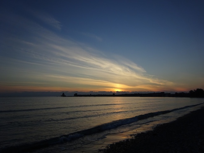
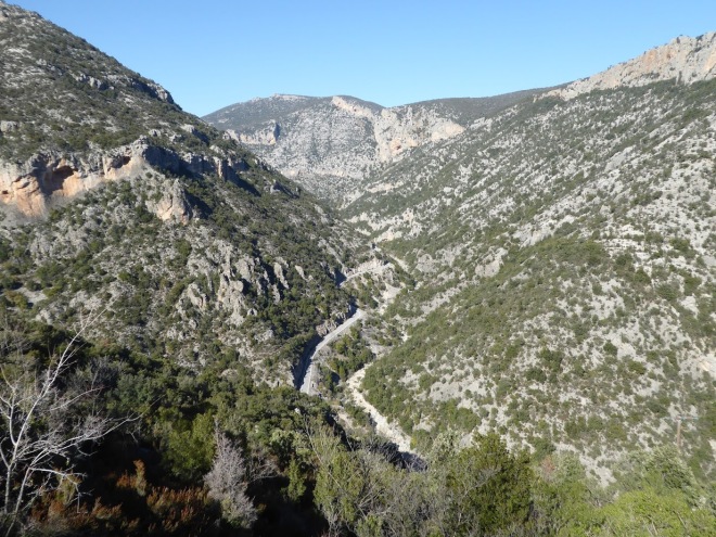
The forty minute boat ride to Eriskay with a tail wind and sunny skies, making it actually pleasantly warm out on deck, proved to be a very enjoyable one with seals spotted basking off the rocks.  Such is the fickle nature of the weather here that the ferries were cancelled the following morning due to inclement conditions (aka: it was blowing an absolute hooly).  If you get some bright weather here you have to make the most of it immediately as it’s sure to change in a matter of hours…….or minutes.  I’m not whinging, just making an observation.


P1120773
A dozen or so seals came into the beach for more sheltered waters.

In the week or so we have been on the islands we have had sunshine, wind, rain, wind, cloud, wind, mist, wind, drizzle, wind, sunshine, wind and wind.  As you can see the wind has been the only consistent element within the mix.  The windswept look is definitely ‘in’ up here.  Again, I’m not moaning I’m just letting you all know that even though it looks all sunny skies in the photos they don’t portray the full picture so to speak.  I’m not about to go out taking pictures of greyness just to show the other side of the weather and anyway even if I’d wanted to I can barely get the door of the van open at such times.  It’s too windy.

P1120769.JPG
I wonder how much washing is lost to the wind on the Islands?

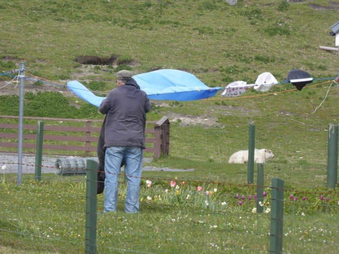
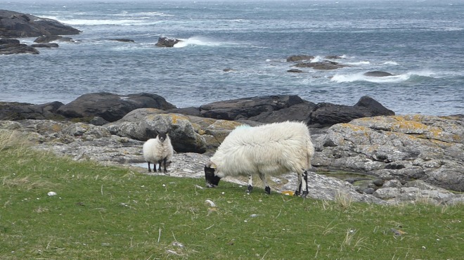
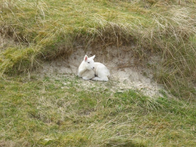
On these occasions (about fifty fifty so far) you’ll find us hunkered down in the van, in our sleeping bags, reading our kindles whilst gently swaying in the gusts.  ‘3’ doesn’t seem to have reached the islands as our mifi hasn’t had a signal since we have been here.  It has actually been really good for me to have an enforced lay-off from the internet as I’ve enjoyed reading a whole lot more when I’m not constantly distracted by the thoughts of ‘oh, I just need to look up such and such’.  There’s too much else to look at anyway.  For example, last night I spent a good couple of hours just enjoying watching two Hebridean lambs frolicking around together on the grass outside the van.  They were having a whale of a time skipping around playing together it was just a joy to watch them.  It had me thinking out loud ‘do only lambs miss out if they don’t have a sibling or do they make friends with other lambs’………..’what, like on Fleecebook’………..très drole Tim, très drole.  The two were joined by another two later in the evening which, I guess, answered that question.

P1120792.JPG
The quartet of quadrupeds who kept me entertained for a couple of hours (photo take from inside the van on South Uist late into the evening).

Back to Eriskay.  Although only measuring just over two miles by one it does have some interesting stories to tell.  Probably the most famous was the sinking of the SS Politician in 1941 on her way from Liverpool to Jamaica which inspired Compton Mackenzie’s book Whisky Galore.  264 000 bottles of whiskey were on board at the time.  Great, finders keepers thought the islanders but Custom and Excise officers thought otherwise and nineteen islanders were found guilty of illegal possession and imprisoned in Inverness.

P1120745.JPG
View to South Uist from Eriskay.

The only pub on the island, the Am Politician, has one of the original bottles.  An Olde Worlde pub it is not but it is welcoming and has a conservatory that heats up nicely when the sun is out which it was when we were there.  Handily, it also has free wifi which was pretty fast so I could upload my photos and the last blog post.  If you have a dog though there is no room at the inn as they aren’t allowed in which is a shame as with all those deserted beaches to play on I can see why dogs would choose the islands as a holiday destination.  Equally the Polachar pub on South Uist (owned by the same people I think) doesn’t allow dogs in either which is a shame if you are either a dog, have a dog or are a dog lover.

P1120752.JPG
More fabulous beaches and coastline.

As an aside, we went to the only pub on Barra at Castlebay and hardly flinched when we were charged £9.80 for two pints as we thought it must be the going rate for the islands.  Later though, and after a change of barman, we were charged £7.20 for two pints of the same beer.  Mmm, odd.  After being charged £6.80 for two pints in the Am Politician the beer barometer says that £9.80 was extortionate and we will be more vigilant next time.

P1120759.JPG
The Post Office within the well stocked village shop which also has a tiny coffee shop.

Another of Eriskay’s claims to fame is that Prince Edward Charles Stuart, or Bonnie Prince Charlie to his friends, landed on the islands main beach in July 1745 at the start of his campaign to regain the throne of Great Britain.  Following his defeat at the Battle of Culloden in April 1746 he fled into hiding on the Outer Hebrides with a price of £30 000 on his head.  After a couple of months keeping a low profile he escaped to the Isle of Skye helped at great personal risk by Flora MacDonald.  You can follow his story by visiting various places associated with him on the islands along the Bonnie Prince Charlie Trail.

P1120747.JPG
Another lovely, simple Hebridean dwelling.

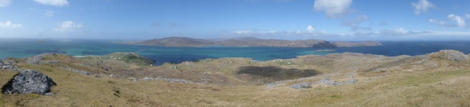
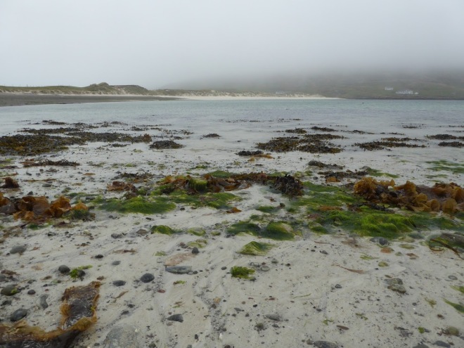
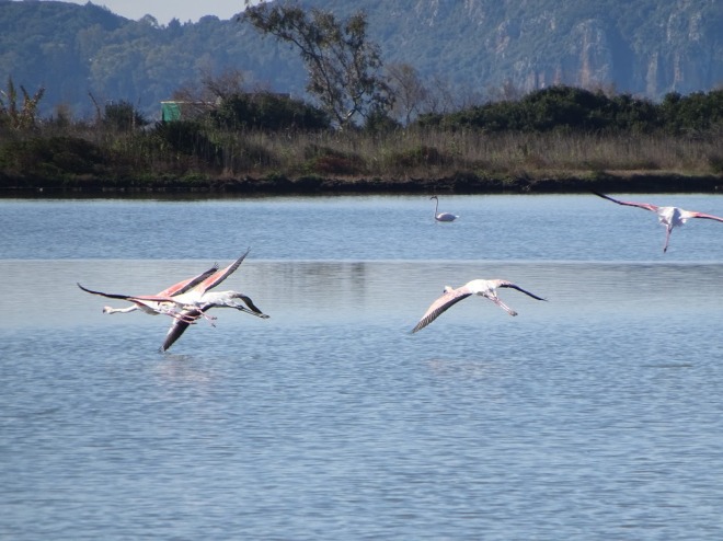
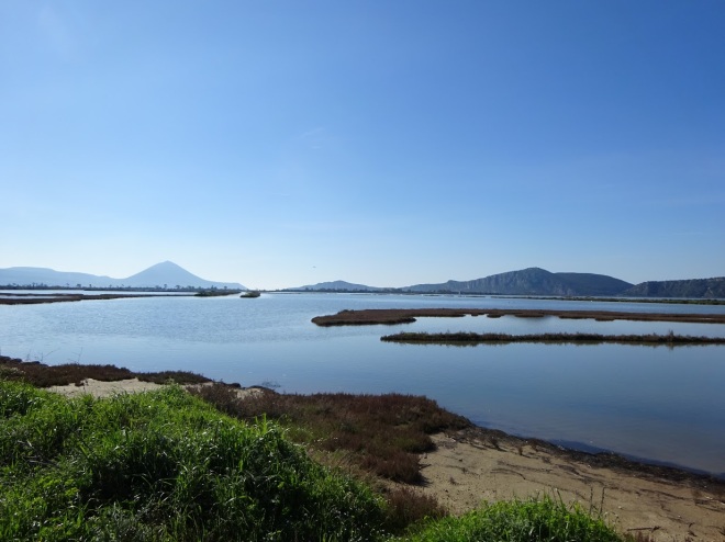
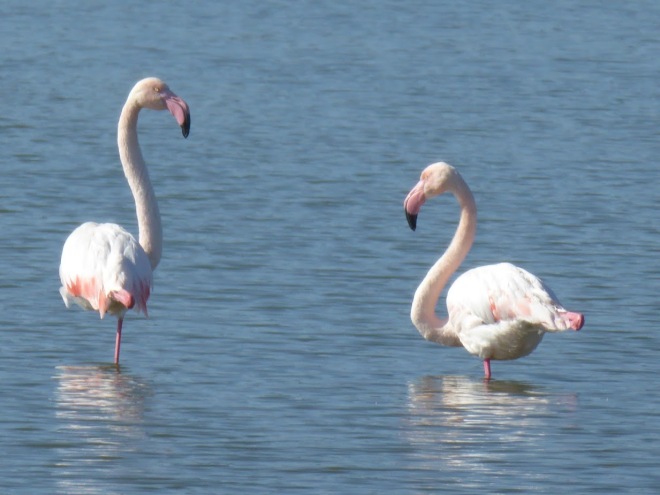
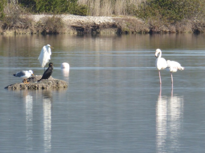
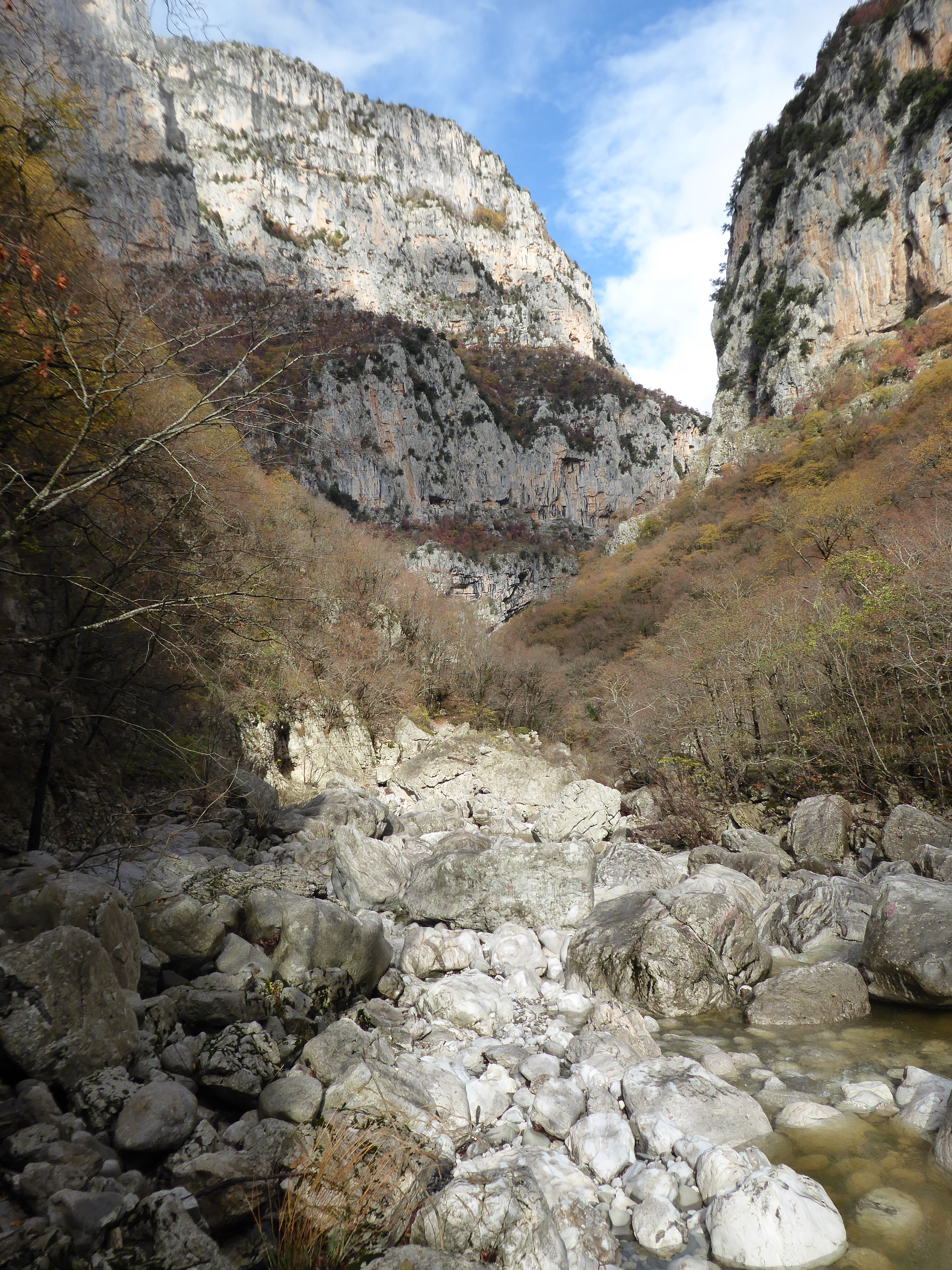
We walked up to the top of Ben Sciathan, the islands highest point, which gives views as far as the islands of Skye, Rhùm, Tiree and Coll.  We were lucky to have clear weather even if it was a tad blowy.   The semi wild Eriskay ponies that roam free on the island can, apparently, often be spotted grazing in the centre of the island around Loch Crakavaig which is the islands only source of fresh water.  Alas, we didn’t spot them.


P1120742
Views towards the causeway which has linked Eriskay to South Uist since 2001.

So that’s Eriskay.  Onwards now across the causeway to South Uist.
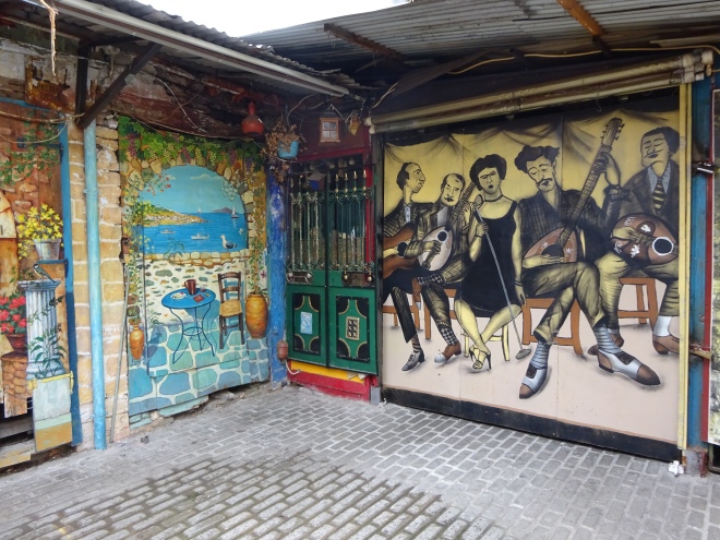
P1120770.JPG
Not a sign you see everyday 🙂 

Feasgar math!

The Outer Hebrides…. .

Arriving on the bonny bonny banks of Loch Lomond just north of Balloch on a calm day in bright sunshine I just thought why?  WHY?  WHHYYY?  Why have I never been to Scotland before now?   What have I been doing all my life to not have experienced this before?  What was the matter with me?  I’ve been all over England and Wales and parts of Southern Ireland so why did I leave out Scotland?  Strolling along the Loch shore into Balloch I started to lament all the missed opportunities over the years.

P1120651
A tranquil Loch Lomond.

With all the rugged hills in the distance contrasting with the stillness of the loch I almost felt like I’d found my spiritual home.  I’d been living half a century in the Westcountry when I should have been born in Scotland!

P1120650.JPG
The sea plane comes in for a smooth landing.

Two days later my questions were answered.  Scotland isn’t green for no reason.  Plenty of rain helps to keep it the way it is.  After a bracing windy walk across the hills near Oban the rain came in and stayed for twenty four hours.  Ah yes, I remember now, that was why I’d never been to Scotland before, the unpredictable weather.

P1120653.JPG
The ferry bound for Barra at Oban.

Living in the South West it’s a looong drive to the Highlands and every time we’d mooted about doing a tour of Scotland for a one or two week holiday we’d always decided against playing Russian roulette with the weather and opted to visit areas closer to home.  Why we were put off by the drive really is beyond me as Tim had many a family holiday in the Highlands in his younger days travelling from Devon with half a dozen other family members crammed into a Hillman Imp borrowed from the next door neighbour!  With more modern transport and road networks it’s hardly the end of the earth but we always found an excuse to go somewhere closer to home.

We had originally planned to ‘do’ Scotland last year but chickened out and went chasing the sun instead.  This year, though, we are ready for it!  Fear not, I am not going to be a whining, whinging, moaning Minnie about the weather whilst we are here.  We are embracing Scotland and all the wild weather it has to throw at us.  The waterproofs are out, we’re layered up and we are ready.

Our first stop in Oban served as a jumping off point for visiting the islands of the Outer Hebrides.  Over two hundred islands make up the Western Isles as they are officially known with just a handful being inhabited by the 28000 or so hardy residents. The plan for the first couple of weeks is to island hop our way from South to North taking in the islands of Barra, Eriskay, Benbecula, South Uist, North Uist, Harris and Lewis before jumping across to the Isle of Skye for a week or so.

P1120655.JPG
Leaving Oban.

Although I usually HATE trips by ferry I was actually quite looking forward to the nearly five hour journey to Barra across the Minch at the southern end of the Isles as for the first half of the journey the boat meanders through a narrow stretch of water flanked on one side by the coast of Western Scotland and on the other by the islands of Mull and Coll.  We’d been lucky that the weather had cleared up and was clear and sunny for the trip over giving us fabulous views all around.  Once out into the open sea though my queasiness took over and I spent much of the time outside on deck trying not to bring up the contents of my lunch.

Arriving on the island in the early evening it struck us almost immediately that the bobble hat is alive and well on Barra.  They are everywhere!  Barra is certainly a bijou island at just eight miles long by four miles wide but it is known as the Western Isles in miniature boasting sandy beaches backed by machair, Gaelic culture, prehistoric ruins and a few mountains thrown in for good measure……….and……..quicksand!

P1120705.JPG

Over the last week we have got out to explore Barra by boot and by bike.  Nearly all the roads are single track but with passing places every few hundred metres or so and little island traffic it has been completely stress free getting from place to place.  Everyone seems to drive at a sensible speed and gives a little wave on passing which is all very civilised and a welcome change from our usual type of driving.

P1120696.JPG
Island residents.
P1120702.JPG
A walk on the western side of the island.

P1120703.JPG
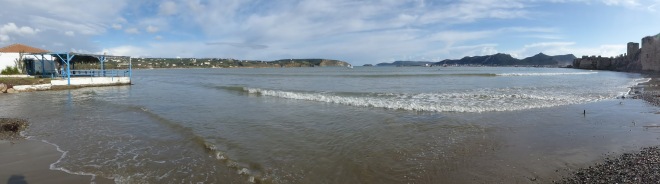
One of the islands claim to fame is that the airport that sits on the edge of Traigh Mhór bay is the only beach runway in the world receiving scheduled flights.  It is quite the attraction.  The runway is tide dependant and the public aren’t allowed on the beach when the windsocks are flying.  Whilst we were walking on the other beach behind the airport a little twin otter plane circled above us in the squally wind and rain getting ready to land but because the dunes are in the way obscuring our view we didn’t see it touch down on the sand.  When we  arrived at the airport cafe fifteen minutes later, the place alive with steaming waterproofs and steaming people, the three cheery ladies working at the cafe were  belting out Gloria Gaynor’s ‘I will survive’.  I guess it must have been a bit of a bumpy landing.

P1120663.JPG
The only scheduled flights in the world to land on a beach.
P1120664.JPG
The tide goes out a looong way.

The plane taxis right up to the airport building to drop off its passengers where they can then take a short walk to the bus shelter around the side of the building which also doubles up as the baggage reclaim.  Fantastic.

P1120665.JPG
Be careful not to slip on the seaweed as you exit the plane.
P1120669.JPG
The baggage handlers go to work.
P1120716.JPG
Also doubles up as the bus shelter!

We whiled away a couple of hours over coffee and cake drying out and soaking up the jovial atmosphere of the place only leaving after the plane had taken off again.

We’ve tramped around various areas of the island in some interesting wild weather but we’ve enjoyed every minute of it.  The beaches are some of the best we have seen on our travels so far with the ground up sea shells giving them their distinctive light colouring.  Learning that the crushed cockleshells are used to make harling (the rendering used on many Scottish houses) changed my opinion of what I deemed to be ugly pebbledash which I had assumed was imported in.

P1120690.JPG
The shells are also used in other ways.
P1120691.JPG
A scallop sea defence.


P1120672.JPG
The beaches are all empty.

P1120674.JPG

P1120675.JPG
I love the contrast of all the colours of the fishing paraphernalia.
P1120676.JPG
Lobster kennels.
P1120678.JPG
You don’t come to the islands for the picturesque villages.

Cycling round the island yesterday in beautiful sunny weather was an absolute treat despite being against the wind for half of it.  Stopping to take photos at low tide with the seaweed revealed captured some of the iconic views that the islands are famous for.

P1120688.JPG
A spring lamb taking five. 
P1120686.JPG
We were going to walk across this field until Tim spotted the bull.
P1120711.JPG
Some of the best beaches we have seen on our trip so far.
P1120720.JPG
That could just be my dream house……
P1120722.JPG
……or that one!
P1120724.JPG
Fab…..u….lous.
P1120731.JPG
Views don’t get better than this.

So far our Scotland trip has already surpassed our expectations and I’m still bashing myself over the head for not having visited before.

Today we hopped onto the ferry which took us, in the warming sunshine, across the water to Eriskay  where we docked forty minutes later scraping our back end on the tarmac coming off the ferry (roll eyes).  It doesn’t take much of an angle to ground out the electrics on our tow bar!

P1120733.JPG
Off to Eriskay.

Happy days 🙂

Mar sin leat!


A finale in France…. .

Sitting in the queue waiting for the ferry to dock at Igoumenitsa we were sad to be leaving Greece but equally excited to be moving on to pastures new.  We’d decided that when we got to the other side at Ancona we would head straight across Italy making a beeline for the south of France to finish Season 2 of our European tour.  Italy will have to wait for another time.

P1120541.JPG
The view arriving at Ancona, Italy.
P1120543.JPG
The boat reverses in to the port.

It was a wise decision to splash the cash for the tolls on the motorways. The roads in Italy really aren’t great.  No, that’s being kind.  The roads in Italy are diabolical.  I know we have only seen a small part of Italy on our travels which isn’t really enough time to make an informed judgement but going by what we have experienced so far I think it’s a fair assessment.  The road surfaces are just crap.  Travelling at any reasonable speed would be pure folly.  If you wear dentures then it’s probably wise to leave them in their jar for the day.  It’s maybe not so bad in a car but in a motorhome it’s oh so tedious.  Constantly being shaken to bits, avoiding lumps, bumps, potholes and humps is just no fun.  It’s also no fun for the other motorists trailing along behind us as we crawl along at a reduced speed.  Even so, it still seemed like a long drive to get to France and it took us two days.

P1120545.JPG
Ah, the joys of being back on busy motorways in Italy.

We were, though, extremely happy to be back in France and both punched the air when going over the border despite the gloomy weather and heavy rain.  We exited the motorway just over the border into France and dropped down the steep winding hill to the wonderful, beautiful, picture postcard town of Menton.  Ah, what a marvellous looking place (even in the pouring rain) set at the foot of a steep hill on the French Riviera.  It was such a shame, then, that we never actually got to see it.

We parked at one of the marinas giving us a view back over the town.  I had a little gander at the parking metre and discovered that you were only allowed to park for a maximum of three and a half hours.  Undeterred we had lunch whilst contemplating our options.  It looked like there was an industrial estate outside the town where we might be able to park up for the night and then come back down to the town in the morning for a look see.  The rain might have stopped by then too.  There was also an Intermarché supermarket there and we needed provisions and diesel.  Tim never tires of cruising the aisles of large supermarkets even though they all seem to sell the same stuff so it would keep him entertained for several hours on a wet day.   Excellent.  Off we went back up the hill in search of a likely place to stay overnight.

We discovered that everything is very compact in Menton, including the Intermarché which has an underground car park with height barriers.  Tim was not to cruise the aisles that day.  The industrial estate was also extremely compact with only on street parking with not a metre of space to be had.  As we were alarmingly low on diesel we swung in to the Intermarché, went down an extremely steep ramp, grounded the tow bar on the tarmac at the bottom, looked at the layout designed for nothing bigger than a Smart car, sat blocking everyone’s way whilst deciding what to do, decided to exit the garage, at the exit changed our minds, swung in to the entrance again, went down the extremely steep ramp, grounded the tow bar on the tarmac once again (rolleyes), and took another go at it.  There wasn’t enough room for us to drive in, fill up, and then follow the one way system around two tight bends to get to the pay booth so I queued up in the rain behind the cars to pay what we owed whilst Tim kept dry in the van.  Obviously, being British I didn’t like to jump the queue.  We then had to reverse back from the pump to get out causing more chaos.

By this time we were a tad fed up with the traffic, the rain and seemingly no options to park up for the night.  We took another attack on the town to see if we could park further along the sea-front but with ‘NO MOTORHOMES’ signs everywhere we gave up, decided to get back onto the motorway, exit at the first services and decide what to do next.  By the time we got to the services we really couldn’t be bothered to move again so stayed the night.  It’s not something we’d normally do, in fact, I don’t think we’ve ever stayed at a motorway services overnight but it’s always nice to do something new for a change!  We slept pretty well considering that lorries were coming and going all night.  This is the reality of living the dream folks 🙂  Those sorts of days are few and far between though and the following morning we awoke to bright sunshine streaming through the skylights, the smell of diesel and lorry engines revving all around us.  I can’t think of a better way to start the day.

On the road again by seven o’clock and having decided that Menton and the French Riviera would be better visited with a car, we headed for the Ardèche Gorge.  The Ardèche is somewhere that we almost visited on a trip to France in 2014 but decided against it as we didn’t fancy spending four days of our two week holiday travelling there and back.  We stopped off on the way at a lovely little free aire complete with picnic benches just outside the village of Chusclan.

P1120546.JPG
The aire at Chusclan.

This is why we love France so much as so many villages provide facilities for camper vans.  We thanked the village for their hospitality by spending the evening at the local bar swapping stories with Pam and Paul who were in the van next to us and on a six week trip.  We also bought some wine from the Chusclan vineyard next door to the aire.  About a dozen motorhomes had stayed the night and nearly all of them had been over to the vineyard to purchase some of their produce.  It’s a win-win.

The Ardèche Gorge is a summer playground for families who enjoy messing about in boats…..or kayaks and rafts to be precise.  The gorge runs for thirty two kilometres from Vallon-Pont-d’Arc down to Saint-Martin-d’Ardeche.  We stopped at a free aire just outside the beautiful village of Aigèze on the other side of the river from Saint-Martin and spent a couple of days walking in the area above and through the gorge.  The sun was out and life was good.

P1120566.JPG
The aire at Aigèze.
P1120555.JPG
A walk up to a viewpoint over the Ardèche gorge.
P1120557.JPG
Aigèze.
P1120558.JPG
We had to breathe in going over the bridge in the van.
DSC05576.JPG
A walk along the river.
P1120565.JPG
A nice spot for some lunch.

Then it got cold…………really cold.  Well, I have get this in perspective.  It was about two or three degrees during the day which isn’t that cold but we’ve been used to balmy temperatures for so long now it was quite the shock to the system.  And there was the wind chill too.  Tim took it all in his stride, switched back to long trousers and layered up.  I just moaned.  And moaned.  And moaned.  I can’t say I’m proud of myself as I didn’t come out of it until the end of the week when the temperatures got back into double figures again.  I was also not a happy bunny when we did the washing at one of those outdoor Intermarché self service machines and it didn’t spin it leaving it soaking wet after the program had finished.  We spent twenty minutes in the supermarket carpark wringing it all out before we could put it into the drier.  Ah, happy days indeed!  Can you tell we’re missing Greece?!

After two days at the aire at Aigèze we drove the D290 which follows the top of the gorge as far as Vallon-Pont-d’Arc.  There were plenty of places to stop and pull over to admire the magnificent views down over the gorge and we had the whole road to ourselves for over an hour.


P1120571.JPG
The river will be chock full of kayakers in the height of the summer.
P1120573.JPG
We’ll come back one summer and hire a canoe.

It was a bit surreal really as not one vehicle passed us in either direction. Weird.

P1120570.JPG
No-one else around.

After twenty five kilometres we realised why when we came to a Route Barrée sign telling us the road up ahead was closed during the day.  Mmm, maybe the locals were in the know but it was the first we’d seen of the closure.  Fortunately we were able to do a detour around but we didn’t get to see the Pont d’Arc natural arch over the river.  Ah well, maybe next time.

For the last few days we’ve been trundling along following the Ardèche river to its source in the Massif-Central area of France stopping at some of the sleepy villages along the way.

P1120589.JPG
Balazac village on the Ardeche.
P1120592.JPG
Vogue.


P1120596.JPG
A pretty section of the Auzon river near Vogue.
P1120602.JPG
Devils Bridge on the Ardeche at Thuyets.


DSC05594.JPG
It was a narrow steep path down to the river from the aire at Thuyets.

It’s time now to head further north.

À bientôt!

An Encore in Greece…. .

What?  An encore in Greece?  What’s going on?  I’d planned to write this blog post whilst on the ferry back to Italy last Thursday as a distraction on the twenty one hour crossing.  I’m not good on ferries and find them interminable.  The time seems to me to drag on endlessly.  I’d be absolutely hopeless on a cruise.  Assuming I wasn’t seasick, which is quite often the case, writing the blog, then, would have kept me absorbed for a significant chunk of time even if I wasn’t able to upload it to the internet.  However, I received a text from the ferry company a couple of days before our scheduled departure date which prompted a rethink of our plans.

The Minoan Lines ferry leaves from Patras, cruises for four or five hours, makes a pitstop at Igoumenitsa further up the Greek coast, before continuing on to Ancona in Italy.  Even though we’d booked the 17:00 ferry to depart on 1st March from Patras the text let us know that we had three options:  ·

  • 1. Depart from Igoumenitsa at 23:00.   ·
  • 2. Depart from Patras at 17:00 the following day.  ·
  • 3.  Have a full refund.

Oh, OK then, no apology, just a bit at the bottom of the text saying ‘thank you for your understanding’.  It’s a three hundred kilometre drive from Patras to Igoumenitsa on toll roads so option number one wasn’t favourable as we’d be out of pocket and the ferry is the same price whichever port you decide to leave from.  Option two sounded pretty good and we were going to go with that.  Ah But…. But….  That was until we read on the news and heard from friends and family about ‘the beast from the east’.  Oh yes, the good old weather in Northern Europe was freeeeeeeezing with ridiculous amounts of SNOW.  It was even snowing in Rome.  Mmm, what to do.  Option three was looking like the best option then.  We’d had several days of rain here in Greece at that point and we were really looking forward to a change of scene and a different country to explore but, if you have read this blog on a regular basis, you’ll know by now that we don’t do SNOW.   We also don’t like being cold if we can help it.  I make no apology for this as we wouldn’t be British if we weren’t always wittering on and whinging about the weather now would we?   So, we took the refund and have decided to stay in Greece a bit longer until the temperatures ‘on the other side’ look a bit more favourable.  After we’d made our decision and contacted the ferry company the sun came out.

That’s it then, now you’re up to speed on where we are I’ll let you know what we have been up to.  Well, we had a break in the weather to visit Ancient Olympia, a religious and athletic centre in its heyday and birthplace of the Olympic Games in 776 BC.  To give Tim a break from driving we took the train from Katakolo harbour where we were parked up for a couple of nights watching the rain run down the windows.

P1120248
Katakolo harbour where we stayed for two nights.

We thought it was an excellent service until we realised we would have to get two buses back as the last train left Olympia at lunchtime and only went as far as Pyrgos anyway (about halfway).  Still, it was an adventure!

Ancient Olympia is in a beautiful setting and we thoroughly enjoyed our wander around the whole site on the first sunny day we’d had in several days.  It was practically empty with few visitors and just the sound of the birds to keep us company.

P1120218.JPG
Remains of the Philippeion, commissioned by Philip II, honours the dynasty of Macedonian kings.
P1120224
The Olympic Stadium.
P1120227
Remains of the vaulted stadium entrance added in 3rd Century BC.
P1120236
Remains of the Leonidaion, accommodated distinguished guests.
P1120240.JPG
Archaeologists still working on the site.

P1120242.JPG

P1120246.JPG
Metope sculptures from the temple of Zeus in the Olympia Archaeological Museum.

After the beautiful day we’d had at Olympia the weather, once again, closed in with rain so we decided to spend a couple of days at Ionion Camping at Glypha further up the coast.  It gave us the chance to get everything recharged and turned around before moving on to what would have been our last stop before leaving Greece.  The campsite is the most modern and tidy site we’ve stayed on in Greece so far but it’s a bit isolated which wouldn’t normally bother us if we are out on the bikes but with the inclement weather it was all a bit dull and miserable.  After two nights we’d walked both ways along the beach and seen what there was to see so it was time to move on.

P1120259.JPG
Camping Ionian at Glypha.  

I’d been saving the Diakoftó to Kalávryta Railway till last on our clockwise trip around the Poleponnese as it was a fifty kilometre drive beyond Patras where we were going to get the ferry from.  Conveniently there is a good size car park at the station in the little village of Daikoftó where we were able to stay for a couple of nights.  Also very conveniently the weather bucked up just at the right time giving us two brilliant days in the area.

Built between 1889 and 1895 by an Italo-French consortium to bring ore down from the Kalávryta area, the narrow gauge railway running from the coast at Diakoftó through the Voraϊkós gorge covers fourteen miles and reaches gradients of up to one in seven in parts.  A third rail (a ‘rack and pinion’ system) helps the little train up the steeper bits.  The original steam locomotives were replaced in 1959 by diesel trains and we were quite surprised that the trains used now are all modern.  We were expecting something a little more rustic but we weren’t disappointed as the route up through the gorge is just magnificent.

P1120264.JPG
The train now is really modern.

The fourteen mile journey through fourteen tunnels and over several bridges took about an hour and we arrived in Kalávryta feeling buoyant.  As the only ones on the train we’d had a ring side seat behind the driver and we were able to keep swapping sides of the carriage to take advantage of the best views.

P1120273.JPG
A ringside seat behind the driver.
P1120285.JPG
View from one of the many bridges.
P1120288.JPG
The train gets really close to the river and practically scrapes down the side of the gorge in parts.
P1120311.JPG
View from the back of the train on our return.

If Tim thought he was going to have a mooch round Kalávryta for a couple of hours before the next train ride back he was sorely mistaken.  I’d planned a walk up to a monument dedicated to the Independence of Greece in 1821 which I thought was doable in the time we had.  It was all on road but only a few cars passed us and it gave us glorious views over the snow capped mountains down through the valley.  We had our lunch sat on the monument enjoying the views.

P1120291.JPG
Flooding after all the rain we’d had.
P1120292.JPG
Views of the hills surrounding Kalávryta.
P1120299.JPG
The monument dedicated to Greece’s independence in 1821.
P1120300.JPG
View across to the hills from the monument.

Back in the village we had time to visit the Holocaust Museum housed in what had once been the village primary school.  A very humbling experience where we left very subdued indeed.  On 13th December 1943, in retaliation for the killing of seventy eight German soldiers by the Greek guerilla resistance fighters, all the male inhabitants of Kalávryta aged twelve and over were marched up to the hill overlooking the town by German troops.  It was there that they were all shot.

Only thirteen of over five hundred of the boys and men survived.  The troops also set fire to the whole village and the primary school where all the women and girls had been locked in but fortunately they managed to escape only to find their husbands and sons dead.  They then had the unenviable task of burying their dead and trying to rebuild their lives.  We walked up to the site where the atrocity happened which is now a memorial to those that lost their lives.

P1120302.JPG
The memorial at Kalávryta to those that lost their lives on 13th December 1943.

The following day we picked up a footpath and walked up through the gorge in bright sunshine passing little goat farms with their ramshackle shelters to follow the route of the train.


P1120395.JPG
Walking through the Voraϊkós gorge.
P1120389
A goat farm nestling in the hillside.

So now with some extended time in Greece we plan to mosey on up to Igoumenitsa to get the ferry back to Italy in a week or so when the weather has settled down a bit.  We’ll leave from whence we came having completed a big lap of Greece taking four months.

Καληνυχτα!

The final finger of the Peloponnese…. .

Well, it was bound to happen at some point on our gallivant around Greece.  An extended period of rain has grounded us.  Meh.  We can’t really complain as we’ve been in the country since the second week of November and any rain we have seen has generally been overnight, just for one or two days, or dried up pretty quickly.  So what better time to update the blog then.  I’m sitting in bed at four o’clock in the afternoon looking out at the rain streaked windows on the windswept harbour at Katakolo whilst writing this.  If it wasn’t for the blog I might be climbing the walls.

Fortunately, the deluge held off until we’d spent an enjoyable few days mooching about in Kóroni and Methóni situated towards the end of the fourth and final finger of our Peloponnese clockwise tour.  The two were both key Venetian ports in their former lives surveying the shipping lanes between the Adriatic and Crete.  First up, then, was Kóroni.  We parked beyond the town and walked the two kilometres along the beach and climbed up the steep hill to take a look at the remains of the castle walls.

P1120156.JPG
Colourful houses on the hill towards the castle at Koroni.
P1120157.JPG
I love the painted pavements.

The Timíou Prodrómou convent occupies the area within the walls and visitors are welcome to take a stroll around the grounds.  An eclectic mix of wrap around garments at the entrance provides suitable respectful cover for those unsuitably dressed.  Tim chose to stay outside.

P1120160.JPG
Outside the convent.

All the buildings are beautifully kept and surrounded by extensive gardens with a few chickens and sheep foraging about.

P1120163.JPG
View over the convent grounds.

The views over the rooftops of the town from the top of a completely unfenced crumbling building with sheer drops of ten metres off any of the sides were superb.  Curiously, it was fenced all the way up the forty or so steps but then at the top………..nothing.  The nuns had made sure they’d covered themselves against any litigation, though, with a sign saying ‘enter at your own risk’.  If I’d had children with me I’d have wanted them on a very short lead.

P1120164.JPG
View down to Koroni harbour.
P1120165.JPG
Compact Koroni.

The town below with its narrow streets and colourful buildings had a lovely feel to it and despite its obvious popularity as one of ‘the’ places to visit on the Peloponnese hasn’t succumbed to the more usual tat shop tourist scene.

P1120158.JPG
Heading down to the harbour.
P1120168.JPG
More pretty painted steps.
P1120170.JPG
View of the castle walls from the harbour.

Methóni, on the other side of the pointy bit of the peninsular, was our next stop.  After our first night in Methóni we realised that the campsite was open.  It didn’t look open as the gate was across and it looked a bit unloved and run down but open it was.  It was rough and ready but the owner was only charging €10 a night with electric, hot showers and use of the washing machine for free which was more than fair.  Shame it was broken though.

We were too late to visit the castle on the day we arrived as all the historic sites close at three o’clock in the winter so Tim decided it was high time he gave his new busking venture a go.  Whilst he entertained a small number of people sitting inside the few cafes and restaurants in the town plaza I kept a low profile and had a mooch around the beach and town.  I can’t watch.  I’m like a tense nervous parent watching their offspring at the Christmas Nativity play.

P1120173.JPG
Billy no mates!
P1120174.JPG
The bay at Methoni, sheltered by Sapientza island.

Apparently all went well and he wasn’t asked to leave so he gave it another crack the next day.  Alas, it was a little bit breezy and a gust blew over his music stand which then knocked his clarinet onto the floor.  So that was the end of that.  It wouldn’t play and now needs repairing.   It’s a cruel world the life of a busker.

To cheer him up we had a walk around the castle.  It hardly seems worth charging an entrance fee at €1 each at this time of year.  A couple of men sitting in the plastic porta cabin just beyond the entrance took our money though and gave us a shiny printed admission ticket.  Surely they can’t be paid to do that?  Surely not?  We were the only ones there.  They must get a handful of visitors at this time of year.  Maybe they were volunteers.  Still, at €1 it was a steal and we thoroughly enjoyed our visit made even more interesting by the rough (for Greece) seas.  We spent a happy half an hour watching the waves crash over the rocks.

P1120179.JPG
The bridge across the moat to Methoni Castle added by the French in 1828.
DSC05354.JPG
Looking out beyond the Venetian sea-gate to the islet of Bourtzi fortified by the Turks.
DSC05357.JPG
A breezy sunny day we had the whole place to ourselves.


P1120187.JPG
The 16th Century octagonal tower.
P1120192.JPG
View back to the castle walls.

The following day seeing as it was a Saturday and lots of people were around Tim braved the busking again.  This time with his back up clarinet.  Oh yes, he’s prepared is our Tim.  He has a spare.  Off he went whilst I read my book.  I met up with him after an hour and found him just packing up whilst swigging a beer.  Mmm, obviously things had gone well then!  Everyone had seemed to enjoy it and he was €8 and a beer better off.  He’d even taken coins off children.  Has he no shame?  Still, if they want to pass over their pocket money who am I to argue?  Not bad, almost minimum wage and this is Greece after all.  Time to celebrate with a beer at one of the cafes and a cheeky Ouzo on the beach before dinner!  I just need to get him out for eight hours a day, seven days a week and he’ll be earning enough to pay for our trip.

DSC05388.JPG
Yay, Ouzo o’clock!
DSC05393.JPG
Sunset over Methoni.

We left Methóni pootling further up the coast for a pitstop in Pylos before going on to Gialova Lagoon where we were hoping we would see flamingos amongst other birds which come every year.  We had a glorious day for the ten kilometre walk around the lagoon having a spot of lunch at the crescent shaped Voidokilia beach.  Fab..u..lous.

DSC05377.JPG
Gialova Lagoon.
DSC05379.JPG
You see how pink they really are when they take flight.
DSC05381.JPG
A lovely, calm, tranquil day to visit.  Perfect.

P1120208.JPG

P1120202.JPG

P1120204.JPG

P1120205.JPG
Views from one of the bird hides.
P1120210.JPG
Voidokilia beach.
DSC05384.JPG
Yeah, right.  We’re not turning back after seven kilometres!

And there ended our good run of weather.  The day before yesterday it rained nearly all day.  Yesterday it rained nearly all day and today it has rained nearly all day.  Whether it’s the weather or the fact that our thoughts have started to drift towards our departure on the ferry next week to Italy we aren’t really feeling the love for this part of the Peloponnese since moving north of the Gialova lagoon.  We can still see the mountains in the distance, some of the time between the low flying clouds, but it is much flatter here and a bit sprawling.  Also, we pulled in to Lidl on Monday morning to find it closed as it was a bank holiday.  Always a disappointment!

I looked out of the window this afternoon and had one of the rare moments when I thought ‘what are we doing here’.  Those times are few and far between though and I’d have been thinking the same thing if I’d been in the UK with similar weather.

We. Must. Not. Grumble!

We may visit Ancient Olympia tomorrow if it’s dry.  There’s a train that runs once a day from where we are in Katakolo.  If I hadn’t seen the train this morning with my very own eyes I’d have never believed the line was still in operation looking at all the grass growing across the tracks.  Leaving the van on the harbour here and going by train will be more of an adventure but only if this weather bucks up.

Yia sas!


A Moody Máni…. .

And so to the Máni, finger number three, of our clockwise tour of the Peloponnese.  It was in bright sunshine that we said a sad farewell to the colourful little town of Gytheio heading for the southern most point of the Peloponnese.  It would take us a few days to get there as we were, once again, in need of a washing machine.  After a long drive of 4.9km we pitched up at Mani camping for the night to get everything turned around as it would be our last chance to find an open campsite until we reached Kalamata which was several days away.  Washing done, waste tanks emptied, water tanks brimming and campsite cats fed we commenced our meander down the Máni.

P1120048.JPG
The view from the beach near Kotronas.
P1120046.JPG
The Maniots must have been quite short as we saw many tiny chapels like this one.
P1120051.JPG
The church in Kotronas.
P1120052.JPG
Curious sheep.

Dominated by the Tygetos mountain range it is wild and rugged, quite different to anywhere else we have been to in Greece.  The fiercely independent Maniots have left their indelible mark on the landscape.  Villages made up of distinct tower houses and byzantine churches clinging to the hillsides blend in with the landscape.

P1120071.JPG
A beautiful day on the Mani peninsular.
P1120063.JPG
Villages blending in to the hillsides.
P1120064.JPG
A closer view.
P1120068.JPG
This has to be the cutest little chapel I’ve ever seen.

The area’s population of over 30 000 in the early 19th Century had slowly dwindled to less than 5000 by the early 1990’s.  We made our way down the eastern side of the peninsular taking it all in.  Having read and heard that the roads were particularly narrow we were quite relieved to see that, other than a few tight spots through the odd village, the roads were pretty good.  It also helped that we only passed a handful of cars coming in the other direction.

P1120054.JPG
Squeezing through Kotronas village.

On our second day we parked up in a large layby six kilometres from the end of the peninsular preferring to walk to the end rather than drive all the way to the tiny hamlet of Kokkinogia as the road did seem to get a tad narrow at that point.  Also the exercise would do us good.

P1120086.JPG
View towards Cape Matapan, the southern most point in Greece.
P1120090.JPG
Our parking spot.
P1120088.JPG
Looking towards the hamlet of Marmari, all closed up for the winter.

We got out of the van making ready for our assault on the southern most tip of the Peloponnese to a strong smell that I can only describe as smelling like cannabis.  Mmm.  Weird. The smell followed us all the way to the village.  Either the Maniot inhabitants have found a more lucrative way to make money or there is another plant that smells similar growing in the area.  We never did get to the bottom of it and with nobody about to ask it will remain a mystery.

The weather started to get a bit blustery but we made it down to the lighthouse for a spot of lunch without the weather closing in on us.

P1120095.JPG
Looking back to Kokkinogia the final village before you fall off the end.
P1120096.JPG
Cape Matapan lighthouse.
P1120097.JPG
A lunch stop with stone table and chairs provided free of charge.

Once back at the van, though, the weather did get more menacing.  Squally showers came and went in waves.

P1120103.JPG
The calm before the storm!

We went to bed that night being buffeted by gusts of wind on our very picturesque but exposed spot on the cliffs above the beach.  It was a loooonnnng looooonnng night.  I’d spent most of it thinking we were doomed.  The wind was snatching at the roof vents, which Tim had secured a few days previously with a Wallace and Gromitesque series of suction hooks and rubber bands.  They were doing a fine job.  If they hadn’t been there I think we’d have probably had three gaping holes in the roof by the morning.  It was reminiscent of a very windy night we’d had in Tarifa in Spain the previous winter but without the luxury of a town to hunker down in a couple of miles away.  Tim did even confess to having had a disturbed night and to thinking, at one point, that we had actually taken off.  My mild hysteria, then, wasn’t completely unfounded.

We had planned on staying another night to do another walk but thought it prudent to ‘get the hell out of there’ before we did, in fact, blow away.  We slowly pulled away from our parking spot heading back up the steep winding road praying that all four wheels remained in contact with the tarmac.  We took refuge in the pretty little port village of Gerolimenas to sit out the weather.  Over several hours, torrential rain came and went until the storm finally blew itself out.  Phew.  When the Máni’s in a mood it’s not a particularly hospitable place to be.

P1120116
See, it’s not always sunny.
P1120112.JPG
Geromilenas after the storm.
P1120111.JPG
Another petite chapel in Geromilenas.
P1120118.JPG
A walk to the next village of Ochia.
P1120121.JPG
Agios Nikolaos church in Ochia and our two companions who’d walked with us from Gerilomenas.

Further north we parked up and pottered around Areópoli, the main town on the western side of the peninsular.

P1120126.JPG
Areopoli.
P1120131.JPG
The back streets of Areopoli.

A pretty little place it is too where a footpath from the bottom of the town took us round to the next bay.

P1120134
The next bay around where you’ll find Pyrgos Dirou cave system, one of the largest and most colourful in Greece.
P1120136.JPG
The walk back.
P1120137.JPG
Wild flowers lined the way.

We’d parked in the large carpark just outside the village next to the school and bus station.  We spent the evening in the adjacent cafe watching the Six Nations Rugby on the laptop whilst troughing pizza, chips, beer and half a kilo of Rosé.  The locals were probably a bit bemused by us eating and drinking glued to the laptop with our headphones on and not exchanging a word.  Who says romance is dead!

P1120148.JPG
A quick pitstop in……..one of the towns along the way………can’t recall the name.
P1120145.JPG
The bay above the little village of Limeni.
P1120151.JPG
Looking across to Aghios Dimitrios.
P1120154.JPG
Sunset on a craggy coastline.

Our six night Máni meander, then, came to an end as we reached the Lidl on the outskirts of Kalamata.  As always, coming back to civilisation is a two edged sword.  We quite like to see more people again but instantly miss the solitude of rolling hills and wilder places.  The marina at Kalamata provides a handy stopover to do all the necessaries for another week of wandering.  Kalamata itself, as far as we made out, didn’t have much to recommend it except for a stroll through the ‘Railway Park’.

DSC05329.JPG
Kalamata Railway Park.

DSC05330.JPG
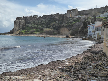
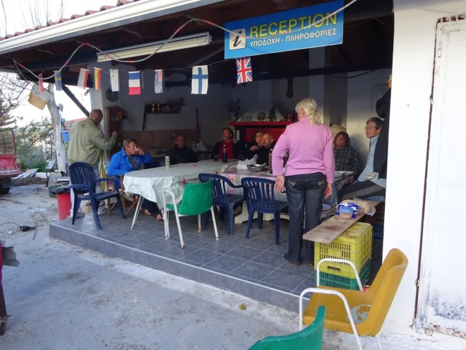
We just stayed the one night and made ready to head off to Koróni but not without first speaking to our English neighbours, Jay and Fi, who had arrived late afternoon the previous day.  They turned out to be an interesting travelling troubadour couple from Edinburgh who seem to have sussed out the ‘work, life, balance’ conundrum.  Work for six months, travel for six months.  They had a big bouncing fluffy white puppy with them who we suspected hadn’t come with them from Scotland.  Said puppy was one lucky girl.  They’d spotted her foraging amongst rubbish on the outskirts of Olympia, gained her trust and taken her in.  You can read about her on their Website.

So I’ll end on that happy story:)

μέχρι την επόμενη φορά!

Biking and hiking on the Peloponnese…. .

After enjoying an extended ten day stop at ancient Corinth where we spent the time chatting to neighbours, cleaning the van inside and out, chatting to neighbours, on line learning, chatting to neighbours, a few bike rides, chatting to neighbours and walking up to Acrocorinth and back several times we hit the road again heading back to Nafplio.

DSC05220.JPG
Barbecue night at the Camperstop in ancient Corinth.
DSC05223.JPG
British, Dutch, French, German, Austrian and Greek campers. 

The main reason we had decided to go back to the Camperstop, apart from a bit of a recharge, regroup and a relax, was that Tim was waiting for a parcel to be delivered to the Post Office in Nafplio.   Back in Nafplio, we waited.  And waited.  And waited.  We weren’t idle whilst waiting as we always find plenty to do.


P1110810.JPG
We weren’t idle whilst hanging about in Nafplio.
DSC05237.JPG
Of course we found the time to go for an Ouzo tasting night with Sue and Mick  who were our neighbours for a couple of nights.
P1110814.JPG
Agios Nikolaos, a little church built into the cliffs and accessed via a coastal footpath from the carpark at the end of Karathona beach.


P1110821.JPG
The lovely young dog and numerous cats that lived near the church at the end of Karathona beach.  Various people come to feed them.

The tracking history for the parcel showed it was getting closer and closer but not close enough.  It spent three days in Argos which, on closer inspection of the map, we realised was only ten kilometres away.  Long story short, after several emails and phone calls we arranged to pick it up in Argos.  We arrived in Argos and parked up on a busy street outside the town.  Tim went off in search of the delivery depot whilst I stayed in the van in case I had to move it.  He relayed to me later that, unable to find the place, he asked at a local garage for some directions.  After the owners daughter had done her best to translate the directions Tim obviously must have still looked puzzled as the owner called over one of his young employees and said ‘he take you’.  Oh, how I wish I’d seen Tim’s face when the young lad nodded to him to clamber onto the back of his moped.  Now, for those of you who know Tim you will know that he is Mr Health and Safety personified.  He won’t even use an electric toothbrush without risk assessing it first.  He just does not do any kind of motorised two wheel transport.  I had a moped for over ten years to zip back and forth to work on and he never once got on it.  So there he was careening round the streets of Argos in a pair of shorts not wearing a crash helmet on a genetically modified moped driven by a multi tasking teenager who had one eye on the road and the other on his mobile phone.  All I can say is he badly wanted that parcel.  You never know, if you get to the end of this blog post I might even tell you what it was.

In all it took two weeks from order to delivery (or not quite delivery).  Curiously, the ACSI card my mum kindly sent to the Nafplio Post Office arrived in a few days.  Finally, then, we left Nafplio for good taking the coast road on the next ‘finger’ of the Peloponnese.  Under a cloudless sky we chugged up and down the coastal road giving us glimpses of little fishing coves all set against a back drop of the Parnon mountain range.

P1110824.JPG
A walk and a lunch stop at Astros.
P1110831.JPG
Views of the Parnon mountain range.
P1110830.JPG
One of several picnic laybys on the coastal road to Leonidio.

We arrived in Leonidio and immediately loved it.  The town nestles in the shadow of a huge red rock at the end of the Dafnon Gorge and the area is popular with sports climbers who have a choice of over a thousand different routes.  It truly is a very beautiful area and we have been waylaid here for the past five days.


P1110838.JPG
Leonidio – you can just see the van to the left of the picture.
P1110852.JPG
Tim had the choice to walk or cycle up the hill above Leonidio to the top of the rock.  He chose to walk – opting out was not an option!
DSC05246.JPG
The views from the top. 
P1110843.JPG
The main road through Leonidio.

It has to be the cleanest town we have been to in Greece.  I haven’t mentioned it before on the blog but we’ve been really saddened to see a huge amount of rubbish, particularly plastic and building rubble, strewn all over Greece.  I’m not having a go at Greece as every country has its fair share of waste issues but we’ve found it particularly prevalent here. There are plenty of large industrial type bins around but many have no lids, are over flowing or just aren’t emptied or used.  Here in Leonidio, though, they seem to be taking a real interest in keeping their town and environment clean and recycling what they can.  I hope that this rolls out to the rest of Greece and sooner rather than later.


P1110860.JPG
Recycling in Leonidio.

We could spend a couple of weeks here just exploring by foot or by bike. We spent a couple of nights parked up on the edge of the town but on Monday morning we were woken up at 6.30am to find ourselves surrounded by the local fruit and veg market.  Ooops.  They were very kind and had left us a gap to get out so we decamped and drove down the valley to the harbour at Plaka four kilometres away to have some breakfast.   We found out that the campsite behind the beach is open so we’ve decided to base ourselves here and stay for a few days.


P1110879.JPG
The harbour at Plaka.
P1110878.JPG
Working out in Plaka!

I’ve been out on the bike whilst Tim has been fettling his new toy.

P1110864.JPG
Out on the bike.  Views back down to the village of  Poulithra.
P1110863.JPG
A dusting of snow and ice on the road near the top of the climb.  
P1110867.JPG
Back down the mountain towards Plaka.

Obviously with the mountains it’s extremely hilly but the effort is so worth it as the scenery is absolutely magnificent.


P1110885.JPG
Spectacular views and quiet roads make for a perfect afternoons cycle.

Sixteen kilometres north of Leonidio, the Monastery of Panagia Elona, built into a cleft in the rock six hundred and fifty metres above the river bed is quite a sight even after experiencing Metéora last year.


P1110882.JPG
You can just see the Panagia Elona monastery clinging to the hillside.
P1110884.JPG
Close up view.

It must be quite a popular pilgrimage site as stalls are set up outside the gate selling local produce like honey and olives. I was the only visitor and was greeted by a monk who showed me around the little chapel.


P1110889.JPG
Inside the monastery with the little chapel at the end.

Anyway, enough of that let’s get back to Tim’s new toy.   Since embarking on our trip around Europe Tim hasn’t had the opportunity to play his clarinet or saxophone as much as he would have liked and he has missed playing in a band.  In a bid to kill two birds with one stone he has decided that he is going to take up the life of a ‘street entertainer extraordinaire’ (aka ‘a busker’).  In order to do that he needed some amplification.  And that is what was in the parcel we were waiting for, a battery powered amp.  He had his inaugural gig yesterday on the harbour front and was invited over to the taverna to knock out a few tunes on their sun terrace.


P1110893.JPG
It beats the draughty streets of  Bath.

Today he whiled away another hour or so playing on the harbour and was thanked by the lady in the shop who said she enjoyed the music.  All in all, it’s a win-win then.  Tim gets to play and people enjoy it. You never know it could become a good side hustle to keep him in beer money.


Before I go I must tell you about the campsite cats.  When we arrived we were greeted by a few cats that were sniffing about.  Obviously being such a soft touch I brought out a bag of food I have (it’s actually dog food for the numerous needy stray dogs we see) but before the food hit the floor another ten cats appeared.  I fed them again this morning and we are now prisoners in our van.  We are completely surrounded.  Most of the cats in Greece are pretty aloof but these ones know how to manipulate.  They have taken to lounging on our chairs, table and bike rack and try to get in the van at every opportunity.  Cooking outside is a nightmare and you can’t go to the washing up area without at least two kittens hanging off your trouser legs.

P1110892.JPG
Oh yes, just sit where you like we’ll just stand!
P1110891.JPG
It’s just as well the barbecue has a lid.

I don’t think our neighbours are too happy with me encouraging them as they keep spraying them with water to keep them away from their van.  I thought I was going to have to go out tonight after dark to feed them but another van has just turned up and the first thing the lady did even before getting their van into position was feed the cats.  Phew, that’s good, the heats off me now.  Oh, how we’ll laugh as they become prisoners in their van tomorrow!


Αντίο!


Metéora… .

I’m sure the drive from Ioánnina to Metéora is very scenic but we weren’t able to see much of it as it was a pea souper for most of the way.  We were mightily pleased we took the E90 motorway to get us two thirds of the way there as the original road would have been a twisty, windy up and down nightmare in the fog.  Numerous lengthy tunnels along the motorway confirmed we’d made the right decision and we were more than happy to pay the €6 toll.  The tolls in Greece are easy as it’s a human at a toll booth.  It would have cost us way more than that in extra diesel and stress taking the other road.  Fortunately by the time we’d come off the motorway to drive the last fifty kilometres or so the fog was coming and going in patches and there were plenty of places we could pull over to let the convoy of cars behind us get past.

Metéora features in the top ten sights to see in Greece attracting thousands of visitors a year.  I’d read about it from several other blogs and was hoping it would live up to my expectations.  Despite the poor weather and not being able to see them clearly the humungous sandstone rock formations towering above the towns of Kalambaka and Kastraki are quite imposing.  Driving through the two towns we wound our way up and up the road through the towers to a viewpoint five kilometres above the town. Arriving at our destination we sat looking at the greyness waiting for the weather to clear.  We’d had a glimpse here and there on the way up of what was to come but the fog/mist was still persistently hanging there obscuring our view.

The natural sandstone towers of Metéora, meaning ‘suspended rocks’, are pretty amazing just as they are but twinned with the monasteries perched right on top they are a wonder.  Hermits saught refuge in the rocks towards the end of the first millennium building small chapels for prayer.   However, the monk, Athanásios, from Mount Athos founded the first and largest monastery, Magálo Metéoro, on one of the pinnacles in the late 14th Century.  Another twenty three monasteries followed but just six are in operation now with others either uninhabited or deserted.

Sitting with a cup of tea looking out at the cars and coaches coming and going I felt very grateful that we had the time to sit out the weather and we hadn’t just got a short window of opportunity to see what we had come to see.  If that had been the case we would have had to leave very disappointed.  After a couple of hours of waiting there was a short interlude in the fog where I was able to jump out and grab a few photos and stand in awe of what was before me.

P1100716.JPG
Rousánou Monastery revealing itself through the fog.


P1100737.JPG
Vaárlam Monastery founded in 1518 is named after the first hermit to live on the rock in 1350.
P1100746.JPG
Vaárlam (left) and Magálo Metéoro (right).

It isn’t really known how the first hermits actually got to the top of the vertical rock faces but it is thought they hammered pegs into gaps in the rock and hauled their building materials to the top.  Other theories claim kites were flown over the tops carrying strings attached to thicker ropes which were made into the first rope ladders.  No mention is made of how many would have lost their lives in the building of the monasteries.  I suspect it was many but the H & S police wouldn’t have been invented then.

DSC04761.JPG
The sandstone towers are a wonder in themselves.

It wasn’t until as late as the 1920’s that stone steps were hewn into the rocks to make them more accessible. They also now have a cable car going back and forth presumably as an easier way to get supplies across but there are pictures of monks travelling in them too.  Prior to that everything and everyone was winched up and down by hand in a rope basket.  Apparently the ropes were only replaced when they broke.  Mmm, a comforting thought.

article-2150810-134B7B77000005DC-241_470x506.jpg
The rope basket.  Picture courtesy of Google images.
P1100833.JPG
The hand winch at Vaárlam.
DSC04764.JPG
The cable car was toing and froing to Vaárlam with nothing in it!

We had hoped to stay a couple of nights at the campsite at Kalambaka, which is open all year, to do some washing and make use of the wifi but a sign on the gate said it was closed for repairs so we stayed in a quiet layby not far from Vaarlam Monastery.  Nobody bothered us and the police must have passed us as when we drove up to the viewpoint in the morning they were taking someone to task for using a drone for some filming.  There was a lot of form filling going on so it’s obviously a no no.

P1100764.JPG

You can just see ‘Ollie’ sitting in his viewpoint carpark below Vaárlam and Magálo Metéoro monasteries.

The six monasteries that are still operational are €3 each to enter so not expensive but there is some stair climbing involved to get to them.  I arrived at Vaarlam at 9.00 am when it opened and practically had the whole place to myself for forty five minutes.  Photos aren’t allowed inside so outside pictures only I’m afraid.  Skirts have to be worn by women but they conveniently provide very fetching stretchy wrap around floral curtains for the purpose.  It was the first time I’d worn a skirt in probably twenty years.  Nope, no photo.

P1100841.JPG
Picture taken from the winch tower of Vaárlam.
P1100852.JPG
The courtyard at Vaárlam.  I was lucky I had the whole place to myself.

After visiting Vaárlam I took a walk along the road which traverses the hillside giving epic views over the rocks and monasteries below.  Most people were driving and stopping at each viewpoint to take a photo but walking was by far the best way to take it all in.  Tim is currently on sick leave with another injury so he was back at the van putting his feet up!  I walked as far as Stéfános monastery but it was closed for lunch so I backtracked and had a look at Agia Triáda (Holy Trinity) which was very quiet.

P1100882.JPG
Agia Triáda (Holy Trinity) Monastery.

That might have been something to do with the one hundred and thirty steps to get up to it.  (I didn’t count them, I took that from Wikipedia)!  Agia Triáda featured in the 1981 James Bond film ‘For Your Eyes Only’.

P1100897.JPG
Some of the 130 steps.

An hours walk on a footpath leading down the hill from Agia Triáda took me across country through the rocks and brought me out to the road below Rousánou monastery.

P1100918.JPG
The approach road to Rousánou where my walk brought me out.  Note the much better weather on day 2!

The following day I took off on my own again with the intention of visiting Magálo Metéoro monastery followed by another walk but when a tour bus overtook me just as I reached the top of the hill I decided to give it a miss and just do the walk.  Maps.Me came to my aid again showing me an unmarked footpath leading to what I thought would be a ruin but was in fact the restored Ypapanti monastery, which is currently uninhabited, suspended halfway up a rockface.

P1100927.JPG
View across to Ypapanti monastery.  Now no longer inhabited.
P1100930.JPG
Close up of Ypapanti Monastery.

What a treat that was.  I’d never have found it without my trusty Maps.Me app.  I had the most fabulous three hour walk through woods and open countryside passing another two churches.

P1100945.JPG
Views across the surrounding countryside.

Metéora then met our expectations and we thoroughly enjoyed our few days there.  Tim expects to be back to fighting fitness again in the next week but I think he is secretly enjoying his respite from me whilst I go out on my own!

καληνυχτα!


Our first foray into Greece…. .

It was fortunate that I’d read the Wanderlings blog on their experience of getting a ferry to Greece from Brindisi.  It wasn’t a surprise, then, when we turned up at the port to find hundreds of Bulgarian plated lorries parked up in the waiting bays.

DSC04602.JPG
Spot the odd one out.

Learning from our Dubrovnik experience I trotted off to the Grimaldi lines check in desk to get our boarding passes.  Whilst waiting for the booth to open up I stoically endured the up and down stares of the fifty or so lorry drivers also waiting to check in.  They weren’t unfriendly up and downers just curious.  We were to be just one of two motorhomes on the ferry.  The rest was freight with the odd car thrown in.

Again, it was an interesting loading procedure.  Or I should say there was no loading procedure.  Without any lanes painted up on the tarmac all the lorries jostled for position spreading themselves six or seven abreast with no apparent order.  The poor little man checking boarding passes was running to and fro between them trying not to get flattened.  The drivers, all with cigarettes clamped firmly between their teeth and presumably well versed in this system, showed no mercy.  One or two beeped their horns shouting and gesticulating if they thought that someone else had jumped the queue in front of them.  Fortunately for us we’d been directed to wait on the left hand side and just watched them all fight it out between themselves.

The loading itself involved some going on forwards and some backwards.  Our turn came and we were relieved to be pointing forwards although we did have to go up a ramp to a different deck.  Once up on the deck the lorries in front were directed to do a U-turn and reverse into their spaces.  We had to turn around and parallel park into a space between two other vans.  At least it was a reasonable sized space and we weren’t packed in as tight this time.

DSC04618.JPG
Safely parked up on the upper deck.

On board the facilities were more functional than fancy and none too clean.  Let’s just say it’s the kind of place you want to wipe your feet on the way out.  If you can get them unstuck from the floor that is.  Docking in Igoumenitsa in the late evening we parked up in the well lit car park at the port and went straight to bed.  No night driving in a new country for us.

The following morning a regroup and a day of planning was called for which required good internet access so we drove the six kilometres or so to Camping Drepanos around the bay from the port.  After twenty four hours of reading, researching and general acclimatising we had a loose plan and we were ready to hit Greece.

DSC04631.JPG
Yay, Greece is now on the map.

After a stock up at Lidl where we found Cheddar Cheese, Chocolate Digestives and Ring Doughnuts (with proper sugar on them) we headed east on the E90 towards Ioannina.  We are using several sources for overnight stops which can be found here, here, here and here. Greece doesn’t really do ‘aires’ and there aren’t too many campsites open at this time of year so these resources, along with some other blogs are proving to be super useful.  Thank you to all of you for sharing your info.

Our loose plan whilst in Greece is to travel across the country inland from West to East then follow the coast in a clockwise direction with a few forays inland finishing up in either Patras or back in Igoumenitsa for a return ferry to Italy sometime in the near or distant future depending on how we get on.

We stopped over night at Ioánnina on our way to the Vikos Gorge.  Ioánnina, set beside the Pamvotida Lake, is the capital of the Epirus region and on first impressions seems to be just a long sprawl of built up urban chaos albeit set in beautiful mountainous countryside.   Parking four kilometres outside the town we walked in and explored the fortress area which dates back to the 13th Century but  was rebuilt in 1815 by Ali Pasha, the Albanian Muslim tyrant.

P1100543.JPG
Ali Pasha Mosque and tomb.  

It was certainly quieter inside the walls of the fortress which was a welcome relief after the walk in along busy roads.  Outside the walls of the fortress we sauntered around a really lively area with an eclectic mix of small businesses and cafes.  Many buildings were empty or semi derelict but the place had a real buzz to it.

DSC04674.JPG
Downtown Ioannina.
P1100555.JPG
Lots of little cafes and small businesses in this area…..
P1100557.JPG
….also lots now closed down.

What we’d really come to this area for though was to see the Vikos Gorge.  With limestone walls rising to over 900 metres the gorge cuts through the Vikos-Aöös National Park.

P1100601.JPG

The gorge is quite simply spectacular.  We drove through the village of Menodendri up to the view point at Oxia.  All I can say is if you have any children or dogs with you then hang on to them as, apart from one small piece of manmade wall, it’s a sheer drop to the bottom of the gorge from the path.

DSC04716.JPG

P1100568.JPG
Vikos Gorge taken from the Oxia viewpoint above Menodreni village.
P1100621.JPG
Not a good place to be if you are afraid of heights.

We stayed a couple of days just outside the village of Monodendri as we wanted to walk part of the 03 Greek National Trail which tracks its way through the bottom of the gorge towards Mikró Pàpigko.  There wasn’t time to walk the length of the gorge as it is a six to seven hour walk one way but we did do part of it.

P1100674.JPG
On the 03 National Trail through the Vikos Gorge.

On the way back towards Monodreni village we found another fantastic viewpoint across the gorge with a birds eye view of the little monastery clinging to the rock face which we’d visited the day before.

P1100701.JPG
Another spectacular viewpoint not far from Menodreni village.  You can just see a little monastery perched on the rocks.
P1100640.JPG
Menodreni village.

Dropping back down to Ioannina we stopped for the night at the little hillside village of Lingiades overlooking the lake before heading off to Metéora.

P1100565.JPG
Our Camper Stop at Lingiades made available by the municipality as an official site for camper vans.

αντιο σας!


Down the Dalmatian coast…. .

Ok.  So.  I’m sitting writing this blog post from the quiet comfort of the library in Harrogate, UK.  Tim is currently ‘home alone’ or maybe I should say ‘van alone’ back in Croatia.  Oh don’t worry, he has a list of chores.  I flew into Leeds Bradford airport on the tail end of Storm Brian last Saturday.  To say it was a bumpy landing is an under statement.  After one aborted landing and a circle around a bit we came in for a second go.  I think it is fair to say the atmosphere on the plane was somewhat tense.  Cheering and clapping commenced as soon as the rubber hit the asphalt.  I don’t think we were quite out of the woods at that point but it did break the tension.   I’ve got to give it to these pilots, trying to tame a bucking Boeing 73 something or other in winds gusting at 40+ mph must be no mean feat.  They deserve whatever they are paid.   End of.

Anyways, meanwhile back on the coast of Croatia last week……….

Leaving Plitvice Lakes National Park we headed back down to the coast taking the A1 toll road to get us through the Velebit mountains.  Oh yes, we’d done our homework this time on how the toll system works in Croatia.  Pay a human at a toll booth.  Simples.  We’d learnt from our past mistake.  Right decision.  Several tunnels, including Sveti Rok tunnel at five kilometres long, convinced us that the alternative route would have been d.i.v.o.r.c.e. inducing.

Pitched up back on the coast at a smallish campsite at Tribanj Šibuljna some more walking was to be had.  And swimming (that’ll be me not Tim, he prefers terra tarmac).

DSC04308.JPG
Campsite at Tribanj Šibuljna .

The weather was superb, the campsite quiet and a footpath across the road led us up and up (and up) into the Paklenica National Park.  The cloud was still hanging low across the sea towards Pag island.  The views were phenom.


P1090840.JPG
Climbing above the cloud.  The sea and Pag island are out there somewhere.
P1090848.JPG
After another hour of climbing the sea and Pag island in the distance were revealed.
DSC04320.JPG
Sunset over Pag island.

Pag island, from a distance, looks like a giant pumice stone.  Just bleak and barren.  Twenty four thousand sheep call it home.  As do eight thousand people. The sheep support themselves mostly from sage which carpets the eastern side of the island.  The people support themselves from the cheese provided by the sheep.  That and tourism, clubbing and olives.  Novalja, one of the main settlements on Pag is said to be the ‘prime venue for Adriatic clubbing’.  I presume it’s not the stone age kind of clubbing.


P1090887.JPG
Pag sheep.

Judging by the size of Šimuni campsite where we stayed for a couple of nights the island must be rammed with people in the height of the summer.  I say campsite but it was more a camping village with restaurants, bars, supermarket, holiday homes, private beach and shower blocks that wouldn’t look out of place in a boutique hotel.  Just enorm.   Out of season with our ACSI card it was about £16 per night and exceedingly quiet.  A bargain.


P1090859.JPG
Our pitch on Pag at Šimuni camping.

The coast of Croatia seems to close by the second week in October.  That suits us but wouldn’t suit everyone.


DSC04339.JPG
Walking the lunar landscape of Pag towards Sveti Vid peak.
DSC04363.JPG
Views from Sveti Vid.
P1090905.JPG
Looking down on Pag town.
P1090898.JPG
Stone stacks on the beach around the coast from the campsite.

Onwards then to Split.

P1090936.JPG
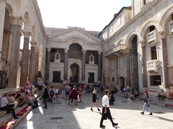
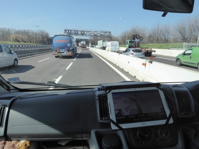
We took the toll road again.  Can’t get enough of them now!  The drive through the outskirts of Split on the D1 is all downhill and pretty dramatic.  Yes it’s exceedingly busy and a culture shock after having tootled about at a leisurely pace for a week or two but the views made up for that.  Backed by an ominous grey wall of mountains, the D1 sweeps down past little hillside settlements and Klis Fortress, a medieval castle teetering on a rock above the city.  We installed ourselves at Camping Stobreč, seven kilometres outside the city.  That is where Tim is now, you know, quietly working his way through his list.

P1090916.JPG
Camping Stobrec.

Before I left for my little sojourn back in blighty we took the bus into Split from just outside the campsite.  Split and around is one of the most urbanized areas of the Adriatic coast.  As with all urbanised areas some of it is pretty grim but the overall situation of the city with the mountainous backdrop is very agreeable.  It’s a lively place even at this time of year with its bustling markets, seafront cafes, ferries, boats and marinas.

P1090928.JPG
One of the markets in Split.
P1090943.JPG
The seafront in Split.

The piece de resistance of Split, for me at least, is its warren of alleys hidden away behind the remains of Diocletian’s Palace. Built in 295 AD by the Roman Emperor Diocletian as a retirement home, measuring 200m by 240m, with a fortified keep and four towers, it must have been quite the des res.  Over the ensuing years after Diocletian’s successors had departed it was gradually, over time, remodelled into a labyrinth of houses, tenements, churches and chapels.  It really is fascinating with so many nooks and crannies to explore.  Boutique shops, little cafes and restaurants sit cheek by jowl with apartments airing the days washing.

P1090952.JPG
Apartments within the old walls of Diocletians palace.
P1090953.JPG
Washing day.
P1090958.JPG
More washing within the walls.
P1090961.JPG
Busy alleyways…..
P1090962.JPG
……and not so busy alleyways.

P1090966.JPG

P1090967.JPG

P1090969.JPG
Diocletian’s Palace.

P1090972.JPG

We loved it.

Zbogom!